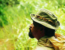
Ritigala is one of a few locations in this country you can get lost. That means really lost. Most of the other places you can not do it any more, as most of the scenic locations or cultural heritage sites now got security guards to manage ( or miss-manage) the property. So where ever you go or whatever you do, they poke in to you and your actions. Even though ritigala is managed by two government institutes both are very good at not managing the land belongs to them. So best results is you are at your own and nobody bullshitting. Its a nice place to get loss, due to its serene environment, no development has touched the location other than few unnecessary sign board by security forces about value of protecting natural environment ( may be they are trying to compensate the destruction done by them to natural forest in minneriya ). Other than that whole forest is intact, of modern human impact. If the archaeology department is bold and strong enough to remove all the notice boards from this property this will be more beautiful place.
On the entrance to the location department of wild life conservation has build a huge concrete structures, the same way they did in bundala, hortan plains and wasgomuwa, in my opinion the worst structures in any natural environment in sri lanka. And near the archaeological site at the entrance closer to “banda pokuna” there is a small structure by archaeological department, fortunately not a eye-sour like wildlife structures.
but when you leave all this behind and enter in to the ritigala proper over the old earth bund of "banda pokuna" you are in a different world. tall trees of dry-zone, cover the whole path like a green ceiling. cacophony of cicadas accompany you all the way without a break, much more pleasing and ear-friendlier than lot of present day fm channnels.


